Showing posts with label forts in pune. Show all posts

Saturday, 7 July 2018

Monsoon trek to Chavand and Naneghat

Monsoon was on peak in Maharashtra and we don’t want to miss the opportunity for the trek. Wanted to avoid crowded and famous trek hence we decided to Visit Chavan fort from Junnar area along with a quick visit to Naneghat.

Trekkers for this trek were I, Himanshu and Aditya.

Chavand Fort
Chavand Fort

About Chavan and Naneghat:
              Chavand fort is in Junnar Taluka and around 15-6km from Junnar town. Fort was built during Satvaahan era. Fort Name was Prasannagad under the rule of Shivaji Maharaj. Chavandwadi is the Base village of the fort.
Naneghat is the mountain pass which was used as a trade route between Konkan (Mumbai Coastal) and ancient town of Junnar. It is around 30km from Junnar town. Mountain pass was built by Satvaahan empire and they carved cave at the entrance which has Brahmi script carved on the wall.

               To reach Chavand from Pune is Pune - Kasarwadi Phata - Pune-Nashik Highway - Take a left at Narayangaon - Junnar - Take the straight road from Shivaji statue - Chavandwadi.
The same road goes to Naneghat and distance from Chavan is around 15km.

GPS Location
Chavand Fort: 19.238097, 73.745905
Naneghat: 19.291958, 73.675661

7 July 2018: Pune - Chavand - Naneghat:
               Wari procession was planned in Pune city so to avoid the traffic, we decided to leave Pune before 5AM. We woke up at 4 and left Pune by 4:45AM. Journey on Nashik Highway was pretty smooth without any traffic. We reached by 6:30AM and had quick breakfast in Junnar town. We moved ahead for base village Chavandwadi. It was cloudy weather with some rain showers. You can view massive but beautiful Chavand fort and it’s rock patch from base village. There is enough space near the village school to park your vehicle.

Chavandwadi village

              We begin our trek. Chavand fort is small and it hardly takes 30-45 min to climb it. Steps were built by local authorities till the rock patch and then steps carved in rocks takes you to the entrance gate. Climbing the steep steps can make you a little tired. Each step is bigger than a regular step. Sometimes it is about a knee high. After climbing the steps, we reached the start point of the rock patch. This part of a trek uphill was indeed pretty interesting. There are few Steps cut in the rock patch. Those are more like small Footholds than the steps. Safely railing and rope with the bolt are mounted on the rock patch for trekkers safety.

Rock patch at Chavand Fort

              We reached the entrance gate after the Short climb. The entrance gate is in good condition and you can see Ganesh Idol on the top of the Entrance gate frame. It indicates that entrance is built/re-Built during the Maratha empire. There are two ways to enter in the fort, the Left route is parallel to fort wall but not in proper shape to explore. Take the right route to go to the top of Fort.

Entrance Gate of Chavand Fort

              After a few step climb, you can see many ruined fortification. It indicates that this fort was used as one of the main forts and not a watchtower. You can see trenches and Stone-pot in few ruined house. From this ruined place, one route goes to the top of the hill. Temple of goddess Chamunda is situated on the hill. Goddess belongs to Bengal/Bihar region. During Satvaahan era, Naneghat was built and it was trading route from coastal to central India. Trading People from Bihar or from Bengal brought the Goddess idol which was established on the fort. Fort name Chavand also came because of Goddess Chamunda. View of Sahyadri from this point is breathtaking. You can see Hadsar, Shivneri, Jeevdhan, and Naneghat fort. We came down to Ruined place after Darshan.

Temple at the top

              We went ahead to explore the fort. We saw the ruined temple. Temple is not in condition but you can see Shivlinga which indicates that the temple belonged to Lord Shiva. There is a water trench in front of the ruined temple. Some carved broken stones and broken Nandi can be seen in the ruined temple area.

Shiva Temple with broken Nandi and Lake

Ruined Shivliinga inside Shiva Temple

             we moved ahead to explore the fort area. We took right side route after a few meter walks keeping ruined temple on the right side. There are 7 water tanks aligned along each other. It is known as Saptamatrika and name of water tanks given as Brahmi, Maheshwari, Kaumari, Vaishnavi, Varahi, Indrayani & Chamunda which are powerful goddess names. We saw Human-made caves on the North-East side of Fort. There are around 5-6 caves. Local believes that they belonged to Satvaahan ear. Considering the construction of caves, they look like built during Nizam or Memperorempiror. It is mainly used by soldiers and to keep watch on the area. You can see a beautiful view of Manikdoh Dam.

7 Water trenches on Chavand Fort

Saptamatrika water trenches

Man-made Caves

Manikdoh Dam view

              After spending more than an hour, we left the fort. We climbed down quickly and went to our next destination which was Naneghat. Naneghat is the mountain pass which was used as a trade route between Konkan (Mumbai Coastal) and ancient town of Junnar. During the Satvahan era, Pratishtan (Now Paithan) was the capital whereas Jirnnagar (Now Junnar), Tagar (Ter) and Nashik were important cities. The trading route was required for traders from Coastal ports to Satvahan cities and hence Naneghat was built.

Naneghat
Naneghat

Naneghat

               The road is available till the start point of Naneghat. As this mountain pass was used as a trade route, tollbooth was placed to collect toll (Satvahan's currency: Karshapan coins). You can see a large stone pot to collect tolls from traders. Few meters ahead, we saw a Large cave. Cave has Brahmi script carved on the cave wall. This script consists of Numeric information, detail information on Satvahan kings and much more other information as well. You can see few water trenches outside Cave. Entire Trade route built by cutting mountain stone can be seen from here.

Man-made Cave at Naneghat

Stone pot to collect Toll at Naneghat

              Trekkers climb up entire Naneghat which is famous trek route. We climbed down a few meters and came back. We also had a quick climb on the mountain which is above Cave. Mountain peak is known as Nana cha Agatha (Uncle's Thumb) due to its Shape. Peak offers you a breathtaking view of Sahyadri.

Naneghat route

               We returned to Junnar town and had lunch at Multi-spice restaurant. Food was very tasty and service was quick. After lunch, we started our return journey to Pune. We reached home by 9 PM safely ending a pleasurable monsoon trek.

Our Expenses:
  • Car Fuel: INR 1500/-
  • Toll: INR 51/-
  • Breakfast and Coffee at Junnar: INR 185/- for 3 people
  • Lunch at Multi-spice: INR 620/- for 3 people (Starter, Soup, 1 veg dish and Rotis)

My Other travel blogs from the nearby area
Shivneri Fort and Malshej Ghat
Narayangad fort and Amba-Ambika caves

Thanks for reading this Travel Blog. Happy travelling.

Pritesh Kulkarni
Pune.

Saturday, 9 June 2018

Offbeat Trek to Kailasgad Fort

As monsoon begins, it was time for a quick half day trek. We were looking for an offbeat location to avoid the crowd and come up with the kailasgad option.

Trekkers for Kailasgad were I, friends Himanshu, Piyush, and Aditya.

About Kailasgad Fort
Kailasgad fort is located in Mulashi area near backwater of Mulashi Dam. There is hardly anything to see on the fort but the trail to the top is more beautiful.

To reach Kailasgad Fort, the route is Pune - Chandani Chowk - Pirangut - Mulashi - take Right at Nive Bus Stop (GPS 18.492028, 73.419742) - Vaduste Village - park car at Mountain Pass (Khind) (GPS: 18.525334, 73.486817)

Kailasgad Fort
Kailasgad Fort

9th June 2018: Pune - Kailasgad Fort (Total Distance: 150km):
               We woke by 5AM and left Pune by 5:30AM. The weather was perfectly set for trekking conditions. Light rain, Dark clouds, and cool breezes make the journey more joyful. We had breakfast break at JP’s food court, Mulshi village. We reached at Base soon and parked a vehicle on the road. There is Signboard which indicates the way to Kailasgad Fort.

Way to Vadusthe village

             Trek begins with a Small hike on Hill and the same Hill is connected to Kailasgad. The route is narrow with exposed to the valley on your left side. The route was bit slippery but manageable. It takes around 45 min to 1 hour to reach the top of Fort. If you want to enjoy the beauty of the trail rather than Fortification then this is the perfect offbeat trekking place.

The trail to Kailasgad Fort

              While climbing, you will come across a small monsoon waterfall (It is only inflowed during Rainfall). Just take right side direction rather than crossing water stream to continue to reach on the top. Route marks are not clearly visible which may mislead you.
              You can see the Swaraj flag on the top of the fort. View of Backwater and mountain range is simply breathtaking. The expert believes that fort was built during Saatvahan era and No fortification is available on the fort. You can see some ruined rock structure which looks like a ruined house. There is Shivlinga carved in Stone at the end of the fort.

Shivling

View from Kailasgad Fort

              We begin our returned journey and climb down in 30-40 Min. It is a short trek and better to club with Ghangad fort. We took stop at andharban valley viewpoint. View of Andharban valley is simply awesome. Andharban is famous jungle trek of 12km which goes through the dense forest.
After spending some time at Valley viewpoint, we returned home safely by the lunchtime.

View of Andharban valley
Expenses:
  • Fuel - INR 900/- at 84Rs/L
  • Breakfast at JP foods- INR 350/- for 4 people (Misal+Upama+Idali Sambar+Tea/Coffee)
  • Dilkhush Wadapav - INR 90/- (INR15/- per pic)


Thanks for reading this Travel Blog. I will try to upload more and more travel blogs.

Pritesh Kulkarni
Pune

Sunday, 17 December 2017

Pratapgad Fort: Mahabaleshwar

We visited Mahabaleshwar multiple times but never able to visit Beautiful Pratapgad Fort. we planned a separate trip to Fort and went on Pratapgad. Fort holds a very important position in history due to the great battle of Pratapgad between Shivaji Maharaj and Afzal Khan won by Shivaji Maharaj.
Travellers for this trip were I and Renuka.

Pratapgad Fort
Pratapgad Fort
About Pratapgad Fort:
              Pratapgad fort is located 20-22km from Mahabaleshwar. The Fort is 3540 ft above sea level. It was built 1656 by Moropant Trimbak Pingle who was a loyal Prime minister under King Shivaji. The main purpose of the fort in order to defend the banks of the Nira and the Koyna rivers, and to defend the Par pass.
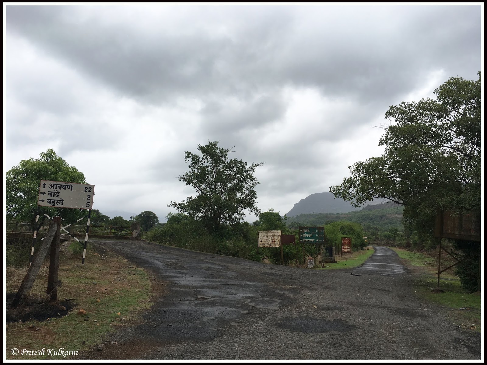
              Pune to Pratapgad is a 3 to 3.30 hours’ drive. Best way to reach Mahabaleshwar is Pune – National highway 4 – After 75 km journey on NH4 Take right at Surul – Wai – Panchgani – Mahabaleshwar - Pratapgad. There are many signboards which guide you to Mahabaleshwar and at all tourist points.

GPS Location: 17.933032, 73.580706

18 December 2017: Pune - Pratapgad - Pune
              We left Pune by 7 AM. Without taking any pit stop, we reached Pratapgad fort base by 10 AM. NH-4 highway is now extended up to 6 lanes highway. Apart from few patches between Wai Phata and Wai, rest of road is in good condition.
                Limited car parking is available at the base. The Road on the left side of parking goes to the steps of the Fort. After climbing few steps, we reached Mahadarwaja (Main Entrance) which is built between two bastions. There are 2 small rooms which were used by guards. One of the Guardroom has Cannon.

Tehani Buruj

             Take right side route after crossing Mahadarwaja for Tehani Buruj (Watchtower). This is the famous bastions which always shown in Pratapgad fort's photo. It was used to keep a close watch on the nearby valley. Watchtower offers you a beautiful breathtaking valley view. You can see Fort view from this bastion as bastion lies on the lower part of the fort. After spending some time on Bastion, we returned towards entrance gate. There are steps which take you to the upper part of the Fort. You can see the Lake on your right side while climbing the steps. This Lake is known as Rahat Lake. There are total 4 lakes on the fort.

Pratapgad Fort
Pratapgad Fort

Lake at Pratapgad Fort

              We went to the top of fort first where Status of Shivaji Maharaj is mounted on the horse with a sword in his right hand. Status was unveiled by late Jawaharlal Nehru (Prime mister). As per locals, this place was used to be a palace of Shivaji Maharaj. This point is a topmost point fort also known as Bale Killa.
              We settle down here and had a good discussion on the fort history. Whenever we visit any fort, we love to read/discuss on the fort and about its history. It gives you different perception to explore the fort. This was the Hill known as "Bhorpya" which was used as a watchtower. Shivaji Maharaj captured the place and ordered to construct the fort. Fort was built under Shivaji Maharaja's Prime minster 'Moropant Pingle'. During Maratha emperor, Prime minister was recognized as Peshwa. Fort came into limelight due to Battle between Maharaj and Afzal Khan.
              Afzal Khan was strongest and powerful warrior from Adilshah emperor. He was ordered to capture or kill Shivaji Maharaj by Adilshah Sultan. He came along with 20000 cavalries, more than 15000 infantry, 1500 gun army, 15000 Khan's personal army, 100+ elephant base army, 1000+ camel base army and 150+ canons for battle (Count varies in different books). Shivaji Maharaj was in Pune at that time and he knew that defeating around Pune not possible hence he moved to Pratapgad. Considering Pratapgad and nearby hill terrain, Afzal's most of the army was useless in battle. He settles down in Wai as he was aware of wai area.
              Shivaji offered meeting at the base of Pratapgad which was agreed by Afzal Khan. He agreed with one condition that meeting will take place with few armed bodyguards and leader without any weapons. The meeting was scheduled for 10 November 1659. Afzal Khan joins the meeting place with Katyar (Small sword) hidden under a cloth. Shivaji Maharaj was aware the intention of Khan and he wears protective armor under clothes. Also, Shivaji Maharaj carried weapon Vagh Nakh (Weapon looks like Tiger claws made up of sharp iron) for self-defense.
              During the meeting, Afzal gave tight hug to Maharaj and struck him with a small sword. Shivaji Maharaj was saved by armor. As counter attach, Maharaj attack Khan with Wagh Nakh. Injured Khan ran out of Tent (Meeting place) for help. Sayyad Banda (Khan's bodyguard) attacked Shivaji Maharaj but Jiva Mahala (Shivaji's Bodyguard) intervened and chopped Sayyad Banda's hand by the sword. This event remembered in Marathi as "Hota Jiva Mhanun vachala Shiva" which means because of Jiva, Shiva lived.

Pratapgad Fort

              Afzal Khan went in Palkhi (non-wheel Vehicle to carry leader) but Palkhi lifters were attached by Shivaji's bodyguard Sambhaji Kavji. He killed Afzal Khan. After war, Shivaji Maharaj sent Afzal Khan's head to Rajgad to show it to Jijabai (Shivaji Maharaj's mother) as Shahaji Raje (Father of Shivaji Maharaj) was captive of Afzal Khan and Afzal played the main role to kill Sambhaji (Elder son of Shahaji Raje, Do not confuse with Sambhaji Maharaj as he was son of Shivaji Maharaj. Same name was used in multiple generations)
               After Afzal's death, Shivaji Maharaj gave a sign (By lighting cannons) to attack Afzal's army. quick action by Shivaji's army and without Afzal Khan, his army fail to fight. Adilshah lost too many armies (more than 13000) which was a major set back to his emperor. Shivaji Maharaj won many weapons, cannons, horse, elephant, camel, stored gains, and money. All captured war of prisoners were sent back to Bijapur with proper respect. This remarkable victory made Shivaji Maharaj hero in the emperor and famous as great mind warrior within India at that time. Shivaji also buried Afzal Khan as per Islamic customs and built his tomb near Pratapgarh, as per his philosophy of ‘once the enemy is dead, the enmity is dead too’.
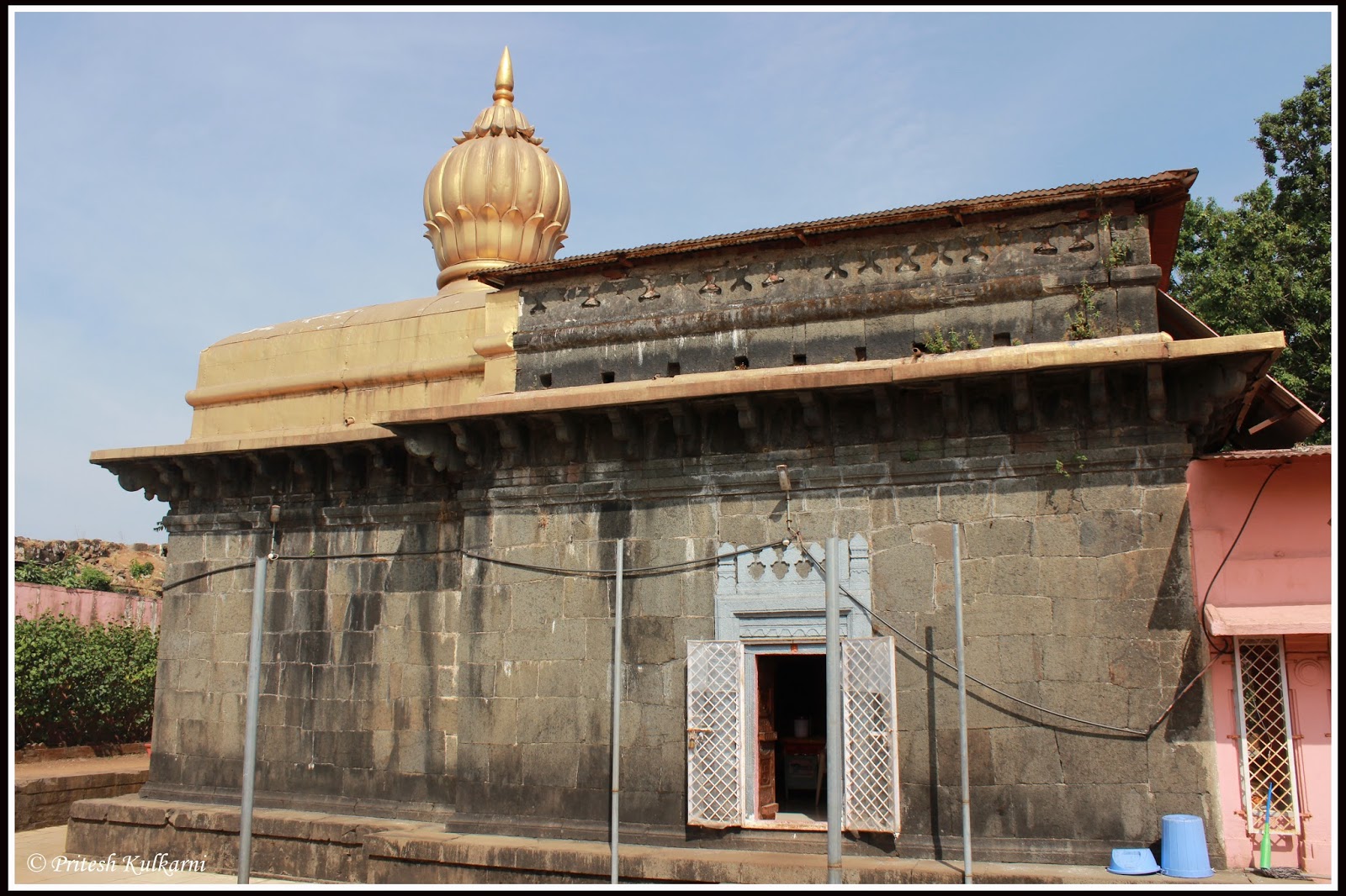
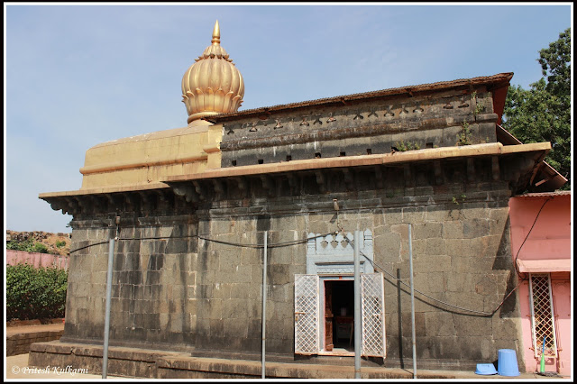
              We left the Status to explore remaining part of the Fort. We visited Keshawraj temple which is located on Bale Killa. There is small place opposite to temple which is known as Sadar. A place built for important meeting and discussions.
              After Climbing down, we visited Bhavani Temple. Idol was curved from the rock which was brought from the convergence point of three rivers namely; Trishul Gandaki, Shwet Gandaki, and Saraswati. Temple also have Shivpindi made up of transparent crystal stone. you can see small cannons from Maratha emperor kept in temple campus. There is a sword of the warrior Hambirrao Mohite, over which his name is engraved along with a sign of ‘6 Star’. (One Star was awarded to a person who kills 100 enemy soldiers).

Bhavani Mata temple

Small Cannons at Bhavani temple

              There is Hastakala Kendra shop for handicraft product. View of Tehani Buruj (Watchtower bastion) is beautiful. After a quick visit to the shop, we took a lunch break at hotel Rasoi. It is opposite side of Bhavani temple entrance. You can have a tasty Maharashtrian meal here along with the fort view.

Lunch Time

Tasty Meal

                We left beautiful fort after lunch. At the base of the fort, you can see Tomb of Afzal Khan and his faithful bodyguard, Sayyed Banda. Due to some political issue, entry to visit this place is banned. There are Hastakala Kendra handicraft shop and miniature village which takes you into Maratha emperor era.


              We visited Mahabaleshwar market for some quick shopping and then tasty Strawberry with cream as dessert in Bagicha ice cream parlor. As we wanted to spend our evening time at table land, we proceed to Panchgani for Tableland. It is 2nd longest mountain plateau in Asia.We were least interested in riding so we had a nice walk on tableland. We spend sunset time together on tableland and then left Panchgani.

Tableland at Panchgani

Expenses:
  • Car Petrol: INR 1500/-
  • NH-4 return Toll: INR 130/-
  • Pachgani pollution tax: INR 50/- (For Car)
  • Pachgani Entry tax: INR 20/- per person (valid for 7 days)
  • Mahabaleshwar pollution tax: INR 30/- (For Car)
  • Mahabaleshwar Entry tax: INR 20/- per person (valid for 7 days)
  • Lunch: INR 345/- (Pithale-Vange Masala-Bhakari Thali at 100/-, Curd at 40/- and Extra Bhakari at 25/-)
  • Strawberry with cream: INR 120/-
We reached home safely by via same NH-4 route by 8.30 PM
I will try to upload more and more travel blogs. Thanks for reading this Travel Blog.

PriteshKulkarni
Pune

Saturday, 11 June 2016

Quick Trek to Ghangad, Lonavala

As monsoon begins, many trekkers booked their calendar for treks nearby Pune and Mumbai. On late Friday evening, we (Me, Friend Himanshu & Vishal) decided to go for a trek on Saturday. The weather was set perfectly fine and we decided to for Ghangad fort.

Trekkers for Ghangad fort were me, friends, Himanshu and Vishal.

Ghangad Fort
Ghangad Fort

About Ghangad:
Changed fort located in Lonavala region and the base village is Ekole. Fort is close to Korigad fort and Tel-bail Wall Mountain. This fort was mainly used to keep a watch on the surrounding area. Not much is known about the history of this fort. This fort can be cover in half day OR combined with Korigad for the day trek.

To reach the base village of fort from Pune is Pune – Lonavala – way to Ambi valley - Peth shahpur – After 1-2 km drive, take right turn for Bhamburde village - Bhamburde village – Take right after Bhamburde village – Ekole village

11th June 2016: Ghangad Fort:
               We woke up early morning by 5.30 AM and left Pune by 6.30 AM. On the way, we picked up our friend Vishal and joined Old Pune-Mumbai highway due to less traffic however we came back to Pune via expressway. The drive was wonderful with light rain and cold morning breeze. We took our first pit stop for breakfast at Manshakti center. We enjoyed tasty Vada-Pav as it was drizzling outside. After breakfast, we began our journey towards Peth shahpur village near Ambi valley city.
              After driving through the fog while enjoying the beauty of nature we reached the base village Ekole by 8.45 AM. Without wasting a time, we began our trek. There is sigh board pointing Ghangad route. After small walk towards a hill, we joined forest route laid with rocky steps. After 10-15 min, we reached Garjai temple. Temple area consist of deepmaal (Stone pole to keep oil lamp) and old time Shilalekh (Inscription). There is a small route on the left side which takes you on the fort.

Route to Ghangad from Village
Garjai Temple, Ghangad
Way to Fort from Garjai Temple

               After few meters climb, we reached the entrance gate of the fort. The entrance gate is facing towards East direction. After crossing gate, you can see a large cave. People can use this cave for overnight. On the right side, you can see huge rock inclined on mountain wall. Rock was a part of the mountain which slide down creating nature tunnel. We decided to visit this part while climbing down.

Entrance Gate, Ghangad

                On the other side (left side after entrance gate), you can see a ladder. As per history, there were stone steps which were destroyed by British after capturing fort in 1818. Now Iron Ladder was placed so trekker can climb up on the fort. Be careful while climbing a ladder. At the end of the ladder, there is small metal part penetrated in rock to move further.

Ladder to Climb Ghangad...
Ladder to Climb Ghangad...Be careful in Monsoon...Himanshu looking at Vishal's Climb

                There is Water trench at the end of a ladder which content drinking water and available throughout the year. After Ladder section, we climbed some rocky patches to reach the final entrance gate of the fort. Entrance and other structures are in ruined condition. Be careful on rock patch in monsoon. Shivaji Trail group installed metal rope on rocky patches which make your climb easy.

Water trench at Ghangad
Rocky Climb on Ghangad

               Fort area is quite small and can be covered in just 30 minutes. You can see the main bastion of the fort on the left side after crossing final entrance gate. This was used as a watch tower. We took right side route after entrance gate to explore fort area. There is one water trench which is in ruined condition. At the end of this route, you can see two water trenches.

Entrance to Fort on top, Ghangad
Huge Bastion on Ghangad
View From Ghangad
View From Ghangad

               View from this point is simply breathtaking. You can see Tailbaila Mountain, Sudhagad fort, and Sarasgad fort. We took rest here and enjoyed the different moods of Mother Nature. After capturing nature in camera and group photos, we continued our trail. Walking for few more minute, we reached Fort's bastion. We decided to leave the fort and came down quickly.

View of Tailbaila
View of Tailbaila
View of TailBaila
View of TailBaila
Climbing down from Ghangad

               After crossing Ladder, we saw natural tunnel / stone arch. There is a small route at the end of the stone arch which takes you to water trench. We saw water trench and returned at the entrance gate. Kindly avoid this patch in monsoon even though metal rope is installed in rock for support.

View from ladder at ghangad
View from ladder at Ghangad
Rock arch at Ghangad

               We climb down remaining fort with lighting speed. We left Ghangad by 12 PM and took a lunch break at Manshakti center for Misal Pav. After heavy lunch, we join Expressway and reach home safely.

View from Ghangad
View from Ghangad

Ghangad Fort
Ghangad Fort

Expenses:
  • Car Petrol: INR 1000/- (approx. 14 Lit and 3 people in car)
  • Toll: INR 91/- (Pune to Lonavala one way from old highway)
  • Breakfast: INR 150/- for 3 people (2 Vada Sambar, 4 Vada Pav and 3 coffee)
  • Lunch: INR 285/- for 3 people (3 Misal Pav, 2 Sabudhana Wada and 3 coffee)
  • Toll: INR 117/- (Lonavala to Pune one way on Expressway)
Things to carry for Ghangad trek:
  • A water bottle to carry at least 2 liters of water
  • Some dry food and packed lunch, No suitable food stall is available on Torna fort.
  • Windcheater / jacket / Barsati during monsoon trek.
  • First aid kit
  • Do carry instant energizers like Glucon-D or Tang.
  • A towel or napkin and 2-3 old newspapers
  • Camera to capture best nature movement
  • Better avoid wearing Gold and other ornaments. No need to carry heavy cash.

Thanks for reading this Travel Blog. Happy traveling.

Pritesh Kulkarni
Pune