Sunday 28 June 2015

Short trek to Malhargad Fort / Sonori Fort

After Mangad and korigad fort, we were planning one more offbeat trek. As my parents were interested to join us, we decided to visit the Malhargad Fort. This fort is also known as Sonori Fort. We were expecting light rain shower but it was neither rainy day nor sunny day.

Trekkers for Malhargad were Me, Wife Renuka, Sister Pratima and my parents.

Malhargad Fort (also known as Sonori Fort)

About Malhargad / Sonori Fort:
            Malhargad is located near Saswad, around 47km from Kothrud, Pune. It is also known as Sonori Fort due to the village Sonori situated at the base of the fort. This fort was built in the year 1775 by Peshwa Saradar Krishnaji Madhavrao Panse who was the chief in charge of Tofkhana (Cannon department) of the Peshwa. Fort is said to be the last fort built in Maharashtra by Maratha Empire.

There are two ways to reach at the base village Sonori. One is Pune – Kothrud – Warje bypass – Take a right towards Katraj on bypass highway – Do not go on Navale flyover – Take left side road and take left for Ambegaon – Katraj – At Katraj Chowk, Take right and immediate left for Katraj-Kondhwa road – Drive till T junction and take right and immediate left for Katraj-Saswad Road – On T junction take right for Dive ghat – Dive ghat – Saswad – Ask for Jaydeep Wedding hall – Follow same road till Sonori village – Drive for 1.5 km from village towards Fort base.

Road from Sonori village is not a tar road hence you may need to park the vehicles at Sonori.

Another route is Pune – Swargate – join Pune-Solapur highway – Hadapsar – After Magarpatta Chowk do not take Flyover – Take right turn below flyover for Saswad road (New flyover to take right is under construction) - Dive ghat – Saswad – Ask for Jaydeep Wedding hall – Follow same road till Sonori village – Drive for 1.5 km from village towards Fort base.

There is another trek route from village Zendewadi. For Zendewadi, take left once you climb Dive ghat. This side takes 1.5 hours to climb Malhargad fort as you need to cross small hills before actual climb.

28nd June 2015: Trek to Malhargad/Sonori fort (Total Distance traveled: 96 km)
             On late Saturday evening, we decided to go for a trek on Sunday. We woke up morning by 6 AM and left Pune by 7 AM. Weather was perfectly set for trekking conditions but it changed its mood and Sun started dominating all over the sky. It was a pleasant journey to Sonori village via Dive ghat. From dive ghat, you can see Mastani Lake. Mastani was the second wife of Peshwa Baji Rao I. She is said to have been a beautiful and brave woman. It is believed that while in Pune, Mastani used to go for her bath to a lake made by Bajirao especially for Mastani. We parked our car at the fort base. You can see beautiful view of Fort Malhargad from the base and it’s easy to spot the trekking route to the fort.

Mastani Lake, Dive ghat

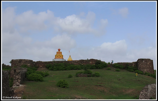
Malhargad fort from Base

           We started walking towards the Fort base. From parking point you will come across a small rough road. Follow this road for around 100-200 meters which will take you to a base of fort. Trust me there is no define route to reach at the top. You can climb from any side and reach at the fort bastion. Mainly trekkers follow the right side route (When your facing to fort) to reach at the main entrance gate. Climbing from left side of the fort takes you to the back side of fort.
             Climb to the top of the fort should take less than one hour. As my parents (age 60+) were climbing with me, we took breaks at regular intervals to gain energy. After 1.25 hour of hike, we reached on top of Fort. Soon we reached the first gate of the Malhargad fort. Main entrance is in good condition. You can see ruined rooms on both sides of the gate. Overall fort head area is small in size. You need around 2 hours to see in detail else 1 hour is enough to explore the fort.

Entrance Bistion of Malhargad fort
Entrance Bastion of Malhargad fort

Info Board on Fort

Entrance Gate

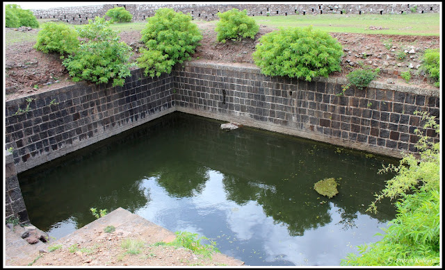
           On the small plateau, you can see small square shape platform and a well. Entrance to Bale Killa (Small fort OR Main fort constructed above fort) is on the right side. Once you enter inside the fort from the gate, you can see two temples side by side. Smaller temple is of Lord Khandoba and the larger temple is of Lord Mahadev. The fort has been named Malhargad because of the temple of Lord Khandoba. Lord Khandoba is also known as Lord Malhar. Bale Killa is small in shape. Just besides Bale Killa, you can see larger size water trench. The Maratha’s purpose behind the building Malhargad was to keep an eye on Dive Ghat which is along the Pune-Saswad route.

Fort view from Entrance Bastion
Fort view from Entrance Bastion  

A well on fort

Entrance to Bale killa, Malhargad
Entrance to Bale killa

Lord Mahadev and Lord Khandoba temples

            We explored other parts of the fort and two bastions. After exploring fort area, we had homemade packed breakfast on the fort. Peace of the fort, nature’s beauty with cool breeze was best way to get refresh. After sightseeing and breakfast, we started descending at 10.30 AM. For descend we chose south-east route (i.e. left most bastion). This route was longer one as compare to other but easy for my parents to get down safely. We reached at the base within 30 min. After we reached at our parked vehicle at base village, we left this historical place. There is a Peshwa Saradar Panse’s palace in the Sonori village. Palace is in ruined condition along with wall, bastion and Temple. We left Sonori village for Pune by 12.30 PM and reach home safely after lunch by 3 PM.

Water Trench on Malhargad Fort

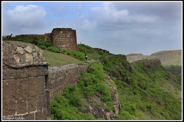
Malhargad Fort area
Malhargad Fort area

Lord Mahadev temple

Descending from Other side of Malhargad Fort

Things to carry for Malhargad trek:
  • A water bottle to carry at least 2 liters of water 
  • Some dry food, in case you don’t find any suitable food stall 
  • Windcheater / jacket / Barsati during monsoon trek. 
  • Do carry instant energizers like Glucon-D or Tang. (Not required for monsoon treks) 
  • A towel or napkin and 2-3 old newspapers 
  • Camera to capture best nature movement 
  • Better avoid wearing Gold and other ornaments. 
  • No need to carry heavy cash. 

Our Expenses:
  • Car petrol: INR 500/- (approx. 7.7 lit at INR 74.72/lit) 
  • No Expenses on Breakfast as we were caring food from home. Do not expect food in Sonori village so better to have some snacks at Saswad. 
  • Lunch: INR 700/- for 4 person (soup, starter, vegetable dish and Roti)

For Lunch, there are few hotels at Saswad and near dive ghat. There is luxury restaurant named Jadhavgad restaurant near ghat.

Entrance of Malhargad Fort
Entrance Gate
Malhargad Fort View
Malhargad Fort View

Temples on Fort

180 degree Panorama photo of Malhargad fort

iPhone Photography...

Thanks for reading this Travel Blog. Happy traveling. 
Pritesh Kulkarni 

Pune

Sunday 21 June 2015

Quick trek to Korigad Fort, Lonavala

Very heavy rainfall started around Pune so we thought better to go for easy and safe trek. We all wanted to do a short trek on Sunday so we decided to go for Korigad fort near Lonavala.
Due to heavy rain, I was not able to post any good photos. I will surely visit this fort for Photography somewhere in this winter and will post blog again on Korigad Fort.

Trekkers for Korigad fort were me, my wife Renuka, our friends Himanshu - Ketaki, Abhijeet – Manasi and Sangram – Priyanka.

Korigad Fort, Lonavala

About Korigad Fort:
Approximately 25 KMs from Lonavala, there is a village called Peth Shahapur. This village is the base of the Fort Korigad. This region of Pavana is called Maval of Korbarsa. Fort is now maintained by Aamby valley city and from base point; stone steps are laid till the top. Climbing on stone steps was quite easy task and we reached at the top soon.

To reach at the base of fort from Pune is Pune – Join Pune-Mumbai national highway (you can also take express way and take Lonavala exist) – Reach Lonavala – Take a left at Kumar resort – Bushi Dam - Travel towards INS Shivaji – Start climbing ghat section – After ghat section, you will come at Y junction – Take right till Peth Shahapur village.

Other route is Pune – Chadani Chowk – Pirangut – Paud – Take a right at Paud after Bus stand – Hadashi (No need to take Hadashi temple route) – Javan – Take left at Javan village - After crossing Hilton resort, look for proper T junction (Javan to T junction distance is around 14 km) – Take left at T junction and drive for 6-7 km. You will reach at Y junction and take you turn towards left to reach at Peth Shahapur village.

21th June 2015: Trek to Korigad (Total Distance traveled: 140 km):
            We woke up early morning by 5 am and left Pune by 6.30 after meeting other trekkers in Kothrud area. We all knew the roads and we were going to travel in our four wheelers. It was raining heavily right from the beginning of the trek till we came back home. We preferred the Old Mumbai-Pune highway from Chadani Chowk. Drive was wonderful with heavy rain and cold morning breeze. We took break at Manshakti center canteen for tasty snacks but unfortunately it was to open at 7.30 AM and we reached there by 6:45 AM. We moved ahead and had breakfast at Hotel Ram Krishna at Lonavala. After driving through the fog while enjoying the beauty of nature we reached the base village by 8.15 AM.

Road to Korigad Fort

Korigad in cloud
Korigad in Cloud

           We parked our vehicles at Peth Shahapur and began with our easy level trek to Korigad fort. We need to walk for 1-1.5 km to reach at the starting point of stone steps. While walking on that route if you feel that you are leaving fort behind (on right side) then don’t worry, you are on right track. The easy way to reach the steps is to travel towards the tallest lamp post that is there near the steps. You can also take forest route but make sure to travel towards lamp post.

Forest route

           We preferred forest route to explore dense forest. We were aware of fort area and well experienced in trekking condition. If you are new to any fort area it is always better to follow the main route for safety. After few minute walk, we reached at the midpoint of stone steps route. Climbing on steps is easy task. En route the top, there is a small cave and Ganesh temple. In monsoon, waterfall flows on steps which make your climb more interesting. 

Steps to fort

Water flow on steps...

Silky flow of water...Korigad Fort

Ganesh temple and Cave

           Soon we reached at the first entrance gate of Fort known as Ganesh Darwaja. You can see ruined structure of the fort. After few meter walk, you can see Shiv temple and Lakes. Take a walk towards left to reach at the bison where Temple of Goddess Korai Devi is located. This temple has been renovated recently. There is a “DEEPMALA” right in front of the temple. The idol of Korai Devi is around 4 feet high.

Entrance of Fort

Korigad temple

Korai temple
Korai temple

            The fortification of this fort is quite undestroyed. You can spot many bastions on the fort especially on the southern side. This fort hosts 6 cannons and the biggest of them called Lakshmi Cannon is near the temple of Goddess Korai. Due to heavy monsoon we were unable to explore fort in detail. We were walking in clouds and unable to see any natural beauty around fort. Photo posted in this blog are taken during our last 2-3 visits in 2 year of span. I will visit this fort once again in winter for better photographs and for detail information.

Gad matha

Fort's massive fort


           Before I write further, I would like to share some history about Korigad fort. Shivaji Maharaj (Maratha Empire) incorporated this fort in Swarajya along with Lohgad, Visapur, Tung and Tikona in 1657. Fort was then handed-over to Peshawa (Maratha Empire). This fort was mainly use to keep control over Maval region. On 11 March 1818, British officer Col. Prother tried to win the fort in battle but even after a lengthy siege could not make any progress. After 3 days, finally he managed to hit ammunition storage by cannon and this fort went to the British.

We started descending at 10.30 AM. To avoid traffic in Lonavala, we preferred Mulshi route. We left the village and reached home safely ending the pleasurable monsoon trek.

Things to carry for trek:
  • A water bottle to carry at least 1.5 liters of water
  • Some dry food, in case you don’t find any suitable food stalls
  • Windcheater / jacket / Barsati during monsoon trek.
  • Do carry instant energizers like Glucon-D or Tang (Not required in Monsoon time).
  • A towel or napkin and 2-3 old newspapers
  • Small first aid kit
  • Camera to capture best nature moments
  • Better avoid wearing Gold and other ornaments. No need to carry heavy cash.
Our expense:
  • Car petrol: INR 800/- (approx. 10.8 lit at INR 74/lit)
  • Toll on Old Pune-Mumbai highway: INR 60/- One way
  • Breakfast: As Per order (Average INR 70-90/- per person along with tea/coffee)
  • Parking at Peth Shahapur – INR 20 for a car

Thanks for reading this Travel Blog. Happy traveling.
Pritesh Kulkarni, 
Pune

Sunday 7 June 2015

Quick offbeat trek to Mangad Fort

As monsoon was about to start, me and Renu decided to start some trekking activity. We planned offbeat Mangad trek on 7th June 2015. It was a half day trek. We were expecting light rain on that day but it turned out to be bright sunny day.

Mangad Fort
Mangad Fort

Trekkers for Mangad fort were me, my wife Renuka, my office friends Rohan and Sree Harsha.

About Mangad Fort and route:
Fort Mangad is small fort situated in Mashidwadi village near Borwadi. Fort is 10km away from Nizampur town. After construction of Raigad fort as a capital of Maratha (Swarajya) empire, Shivaji Raje built a chain of forts to make Capital more strong. These fort chains consist of Mangad, Kurdugad, Panhalghar, Songad, Chambhargad and Lingana.

Mangad fort was used for Raigad’s protection and to warn/prevent enemies attack on Raigad. Not much is known about the history of this fort. Mashidwadi is the base village of Mangad fort

To reach at the base village of fort from Pune is Pune - Chadani Chowk – Pirangut – Paud – Tamhini Ghat – Nijampur – Take a left at Nizampur (Sign board for Raigad is present at junction) – Borwadi – Mashidwadi.

14th June 2012: Trek to Mangad (2 hr. of Journey + 30 min climb):
            We woke up early morning by 5.30 am and left Pune by 6.15 after meeting other friends in Kothrud area. We were expecting light rain shower as weather was bit cloudy in Tamhini Ghat. We took a pit stop for breakfast at Hotel Quick Bite. It was a pleasant journey till base village. There are enough boards to guide you once you take left turn at Nijampur.
           We reached at Mashidwadi by 9 AM. The atmosphere changed its mood regularly, sometimes cloudy, sometimes wind playing with us and sometimes sudden focus from sun glowing up the vegetation. Trek route is simple and straight forward. It just takes 20-30 min of time to reach at the top of fort. There is a Vinjhai temple midway before starting stairs to reach at the top. Steps are curved in the stone which leads us to the main entrance of fort.

Route to Mangad Fort

Vinjhai Temple and Fort

Fort Info

            Main entrance of fort is in good condition. After entering into fort from gate, you can see lord Hanuman idol and fort map board. Take left from temple and you can see 4 water trench and 1 large cave. In history, water trenches were used as source of drinking water whereas cave was used as grain storage. We climb little bit to reach at the top of fort area. 

Steps in Stone

Main Entrance

Lord Hanuman idol and Fort Map

          There are some ruined foundation of fort is present. You can see 2-3 water trenches which are covered by thick grass and bushes. On the top you can find a mansion on a raised platform along with a temple which is in ruins.

Cave to store grains

          From the fort you can see Raigad fort, Konkan Dive peak and birth place village Chatrapati Shahu Maharaj. As I wrote, fort was used for Raigad’s protection and to warn/prevent enemies attack on Raigad. To the south end fort, there is an open ground, where there had been military training. In the Treaty of Purandar, “Mangad Fort” is mentioned. Fort was under Peshwa rule before it was taken in May 1818 by a British officer Captain Prother. 

View from Mangad fort

Base village Mashidwadi

          After resting for 30 min, we decided to descend. It took us hardly 10-15 minute to reach at base village. This offbeat fort is hardly visited by tourist/Trekker. You can club this fort visit along with waterfall trip to Tahmini ghat. We reached home by 4 PM safely ending pleasurable trek.

Jai Maharashtra...

Things to carry for Mangad trek:
  • A water bottle to carry at least 1.5 liters of water
  • Some dry food and packed lunch, No suitable food stall is available on Fort.
  • Windcheater / jacket / Barsati during monsoon trek.
  • First aid kit
  • A towel or napkin and 2-3 old newspapers
  • Camera to capture best nature movement
  • Better avoid wearing Gold and other ornaments. No need to carry heavy cash.
Our Expenses:
  • Car petrol: INR 1600/- (approx. 20 lit at INR 74/lit)
  • Breakfast at Quick bite resort: As per ordered Dish (On average INR 100 per person)
  • Lunch at Durva restaurant near Pirangut: INR 600/- (For 4 people)

Thanks for reading this Travel Blog. Happy traveling.

Pritesh Kulkarni 
Pune